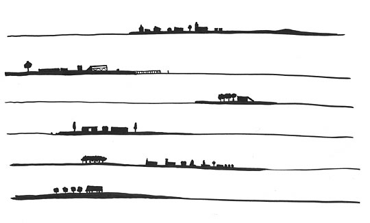
Anonymous, 18th century, this is a vertical map for ships sailing in the Dutch innersea (ijselmeer). The silouettes are of villages, harbours etc.